Single Beam Hydrographic Cross-Sections Survey of the Arkansas River Navigation System
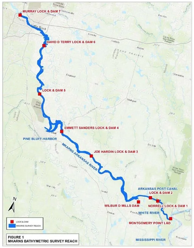
The Little Rock Corps of Engineers contracted EMC to perform single beam hydrographic surveys on the McClellan-Kerr Arkansas River Navigation System (MKARNS) from navigation mile 0.0 (confluence with the Mississippi River) to navigation mile 125.0 (Downstream approach to Murray Lock & Dam 7). The survey cross sections are being collected at 400ft intervals and at sediment range locations
EMC is utilizing our 24 to 28-foot hydro vessels equipped with Odom single beam fathometers and Trimble DGPS systems. EMC’s field crews are running the hydrographic cross sections from water’s edge to water’s edge. The water’s elevations are being determined by running levels from gages on the locks that have known elevations to the surface of the water.
Data is being collected in the field and post-processed in the office. Hydrographic survey data will be delivered in text format (.xyz) containing x, y, z referenced to vertical datum NAVD88 (geoid 18), US feet. The data will be delivered in individual files representing each navigation pool (Montgomery Point – Pool 6). The hydrographic survey data will be delivered in State Plane Arkansas South, NAD 1983 (2011), US Feet. All associated HYPACK files used in the collection and processing of the hydrographic survey data will also be delivered to the Corps.