

High-Definition LiDAR
High-Definition LiDAR
Fully Linear, Unidirectional & Parallel Scans
EMC’s new V-Line 3D Terrestrial/Mobile Laser Scanner provides our clients with high speed, non-contact data acquisition using a narrow infrared laser beam on a fast-scanning mechanism. This system provides our clients with highly accurate laser ranging that is based upon a unique echo digitization and full waveform processing and allows EMC to achieve superior measurement capability even under adverse atmospheric conditions and the evaluation of multiple target echoes. The line scanning mechanism is based upon the fast-rotating multi-faceted polygonal mirror, which provides fully linear, unidirectional and parallel scan lines. EMC’s laser scanner is a compact and lightweight surveying instrument, mountable in any orientation and even under limited space conditions.
Innovative Benefits
Superior Measurement
Digital Imagery
Integrated Inclination Sensor & Laser Plummet
GPS Receiver with Antenna
Various Interfaces
Terrestrial/Mobile Laser Scanning
Full Waveform Processing, (1 beam equals 16 returns)
High Speed Data Acquisition
Wide Field of View
Accurate High Precision Ranging
Multiple Target Capability

3D Terrestrial Scanning
EMC continues to create unique turn-key solutions for the land surveying industry. By utilizing our advanced 3D Terrestrial Laser Scanning System along with GNSS, we are able to provide our clients with survey-grade data acquisition and processing at an unrivaled pace. EMC has perfected surveying techniques with this advanced technology, allowing us to offer our clients solutions that in most circumstances exceed conventional methods of surveying. We now have the ability to collect a vast amount of survey-grade data in a fraction of the time and cost.
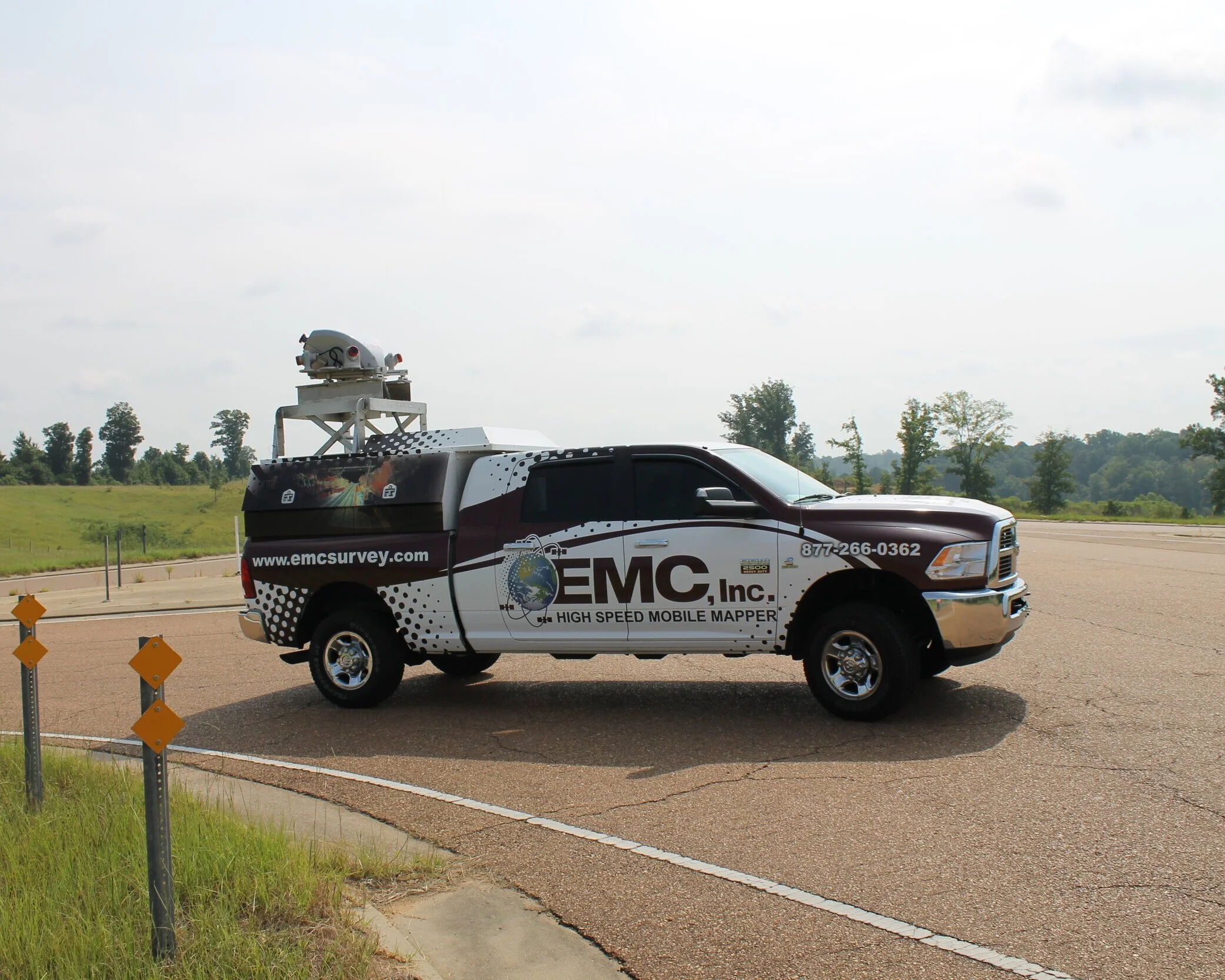
Mobile LiDAR
EMC’s VMX - 450 is the most effective and efficient mobile LiDAR system on the market today, far exceeding traditional surveying techniques. Our system integrates two laser scanners as well as inertial measurement and GNSS equipment, housed under an aerodynamically shaped protective cover. The system also includes a well-designed camera platform allowing it to be mounted and setup up to six high-resolution digital cameras. The VMX system is modular in design which allows for quick setup on different vehicles (or vessels, railcars, etc.), and provides our clients with a fast, highly-accurate, laser ranging that is based upon an unrivaled, echo, signal, digitization technology with online waveform processing providing superior measurement capability.
EMC’s Applications
EMC utilizes our laser scanner for surveying and mapping of roadways, bridges and rail corridors (e.g., route inventory, clearance evaluation, rail gauge determination, etc.), waterways, ports, and harbors (e.g. river banks, jetties, cliffs, etc.), as well as extended urban and rural areas. EMC also uses this system for surveying and engineering measurements, as-built surveying, road and bridge modeling and any civil engineering project where our clients need fast accurate data.