

Government Experience
EMC, Inc. has managed numerous government contracts consisting of hundreds of delivery orders totaling millions of dollars in fees. These delivery orders included such highly specialized projects as a L1/L2 GPS, testing of Coast Guard Navbeacon for the COE, and specialized programs for COE, multi-beam, photogrammetry, and boundary litigation. For these forty contracts, EMC has received numerous excellent and above average ratings. All projects have begun on time and maintained project schedules. When a project is delayed for any reason (weather, site conditions, etc.), we keep our clients informed and strive to make up for delays by working overtime or assigning additional personnel.
EMC has an exceptional record of cost control in the previous contracts. The Quality of Work and Compliance with Performance Schedules are enforced in the work flows and procedures in all projects for our in-house personnel and our sub-contractors.
Summary of EMC’s experience with government contracts:
Twenty-Five years performing land and boundary surveys
Twenty-Five years performing survey engineering projects
Twenty-Five years developing automated topographic surveys with total stations and data collectors
Twenty-Two years performing first order horizontal and vertical control surveys including; Twenty with GPS
Sixteen years performing surveys using RTK
Twenty-Five years developing automated hydrographic surveys- Twenty years with DGPS
Eighteen years using Multibeam hydrographic survey systems
Twenty-One years collecting gauge and discharge measurements on the Mississippi River including ADCP Doppler surveys
Here’s a few of our Government Clients:
NOAA
USACE (United States Army Corps of Engineers)
RCI (Residential Community Initiative)
PAL (Privatization of Army Lodging)
UPH (Unaccompanied Personal Housing)
USFW (US Fish and Wildlife)
NRCS (National Resource Conservation Service)
DOT (Dept. of Transportation)
Numerous other Government and Private entities
Project Experience Includes but is not limited to:
Height Modernization Surveys, in Louisiana
Bluebook ortho ties for grid points, output to NGS Bluebook formats and submitted to NGS
Bluebook supplemental sp points, output to NGS Bluebook formats and submitted to NGS
Bluebook grid points, using GPS high precision techniques
Pictures ties using dual frequency fast static L1/L2 receivers
Providing Primary control for numerous large survey projects
Mississippi River Full Coverage Survey
Miami Harbor Debris Survey
Gulf of Mexico Debris Mapping
Key West Dredging Survey
Gulf of Mexico Pipeline Inspections
Mobile Bay Yellow Hammer Pipeline
Mobile LiDAR; MDOT Project
Levee Construction Layout and Control
Preparing Easements and Boundary Survey for Border Wall; Texas
Boundary Survey for NRCS…Whiskey Island
Energy & Distribution Surveys

LiDAR Scan at Entergy Substation
Aerial Survey of Coal Mine
LiDAR Scan of Substation
Energy & Distribution Surveys
Generating A Reliable Reputation
There are more demands on America’s power industry than ever before. So, whether the job involves routing transmission lines, determining right of way, or locating tower sites, it’s more important than ever to get the most accurate and complete data possible, as fast as possible—the very best intelligence, in other words; and that means EMC Surveying, where we combine the finest talent with the industry's most advance tools and technology. EMC's responsive, cutting-edge service puts your organization ahead every time.
Services include, but not limited to:
Transmission Line Location
Transmission Line Mapping
Utility Corridors
Plan and Profile Preparation
Realignment Surveys
ROW Surveys
Rebuild/As-Built
Route Studies
Substation Surveys
Locating Tower Sites
Subsurface Utility Engineering (SUE)
Boundary Surveys
Topographic Surveys
Construction Staking/Layout
Recent Past Clients Include:
Entergy
Duke Energy
Tallahatchie Valley Electric Power Association
USACE, Norfolk
USFW
NRCS of Mississippi, Louisiana and Florida
Mississippi Dept. of Transportation
UPS
Oil, Gas, and Pipeline Surveys

Oil & Gas Industry
Gathering Insightful Information
EMC provides our clients in the oil and gas industry with pinpoint surveying and mapping services. By accurately and efficiently gathering the right data, EMC provides our clients with the information that affects well site position and construction. From providing the physical features of the terrain to locating hazardous structures, EMC maintains the professional staff and the state-of-the-art equipment needed to handle any surveying and mapping project for our oil and gas industry clients.
Gathering Data for
Drill Site Location Surveys
Well Site Location Surveys
Well Site Construction Surveys
As-Built Surveys
Area Computations Surveys
Pipeline and Well Detection Surveys
Right-of-Way Surveys
Easement Surveys
Acquisition Surveys
Alignment Surveys
Boundary Surveys
Topographic Surveys
Map Preparation and Reproduction
Pipeline Surveys
Location, Location, & Location
EMC has extensive experience surveying oil and gas pipelines. Whether it is a small project or a project that will require multiple phases and multiple years, EMC has the equipment, the knowledge and the experience to manage any pipeline survey.
EMC has performed pipeline construction surveys including design, construction staking and as-built surveys. In addition, EMC has managed many right-of-way and easement surveys for a number of pipeline companies nationwide.
When locating existing pipelines, EMC uses the most efficient technique to locate the pipeline. Once EMC’s professional field crews have located the pipeline, we capture point locations using our state-of-the-art equipment. From these point files, we provide our clients with highly accurate maps and profile drawings.
Leading the Way in:
Pipeline Construction Surveys
Design, Staking, and As-Built
Pipeline Location Surveys
Pipeline Depth of Cover
Right of Way
Easement/Route Survey
Subsurface Utility Engineering (SUE)
Here are a few of our recent clients:
Atmos Energy
Entergy Operations
Entergy Nuclear
Texas Gas Transmission, LLC
Gulf South Pipeline Company, LP
Statoil
EOG Resources
Shell Pipeline Company
Chevron
Boardwalk
Exxon Mobil Corp
Loop, LLC
Justiss Oil and Gas
Enterprise
Central Louisiana Energy Pipeline, LLC.
LiDAR Scan of Pipeline Crossing of River
3D Scanning of Fuel Processing Facility
3d Scanning of Pipeline River Crossing
Pipeline Location and As-built Survey…New Mexico
3D Scan of Newly Installed Pipeline
Construction Surveys

Levee Repair Survey
3D Scan for Road and Drainage Construction
SUE Investigation
Guiding Clients Through All Phases of Construction
On a regular basis, EMC’s team of professionals performs surveying and mapping services for construction projects. EMC has experience in all the facets of construction surveying and mapping such as design, layout, as-built, quantity, control surveys, and subsurface utility engineering. These surveys are typically done with RTK/total stations, automated hydrographic systems, and GPR. These methods of data collection provide EMC with a fast, efficient and accurate survey allowing us to complete the largest of projects in a timely fashion and on budget for our clients.
Experienced, Efficient & Accurate
Levee Enlargements Surveys
Revetment, Dike and Jetty Construction Surveys
Control Structure Construction Surveys
Subsurface Utility Engineering (SUE Surveys)
Lock and Dam Construction Surveys
Minor Levee Construction and Repair Surveys
Building Structure Surveys
Road and Bridge Construction Surveys
Pipeline Construction Surveys
Telecommunication Construction Surveys
Recent Clients Include:
Bertucci Contracting Corporation
Manson Construction Company
Toyota Manufacturing North America
Nissan North America
Manson Gulf
Entergy Nuclear
Kiewit Construction
Gulf IntraCoastal Constructors
Greenhorne & O’Mara
Black & Veatech Corporation
Robinson Construction
Centex
Kiewit Massman Taylor Construction
USACE, New Orleans
USACE, Vicksburg
USACE, Jacksonville
USACE, Mobile
USACE, Memphis
USACE, Norfolk
USACE, St. Louis
Ports, Harbors, & Waterways

Ensuring Safe Navigation, Construction & Maintenance
EMC can provide its clients with an accurate depiction of the existing bottom conditions with our state-of-the-art hydrographic surveying equipment. This system can be paired with one of our mobile LiDAR systems to achieve full coverage. This method allows for accurate clearance information needed for a safe navigational channel. These surveys can be conducted in emergency situations which call for a rapid response or as a periodic monitoring survey to reflect, the ever-changing bottom of these navigational channels.
In addition to ensuring the safe passage for vessels, EMC also has years of experience providing its clients with precise horizontal and vertical data collection and processing for dredge construction surveys.
Project Experience Includes, but not limited to:
Mississippi River
Yazoo River
Red River
Ouachita River
Pearl River
Black River
Ten-Tom Waterway
Pacific Ocean
Gulf of Mexico
Atlantic Ocean
Tampa Harbor
Jacksonville Harbor
Miami Harbor
Steinahatciee River
Pithlachascotte River
St. Johns River
St. Lucie River
Intercoastal Waterway
Mobile Bay
San Francisco Bay
Various harbors and channels
We have also performed pre- and post- annual revetment construction surveys on the Mississippi and Red Rivers.
Our multi-beam experience includes, but is not limited to:
Mississippi River Full Coverage Survey
Miami Harbor Debris Survey
Gulf of Mexico Debris Mapping
Key West Dredging Survey
Gulf of Mexico Pipeline Inspections
Mobile Bay Yellowhammer Pipeline
our single beam Project Experience Includes:
Hydrographic sections on the Mississippi River, Black River, Yazoo River, Tallahatchie River, Yalobusha River, Red River, Ouachita River, Arkansas River, St. Francis River, White River, Wolf River, Loosahatchie River, Rio De La Plata River, Kissimmee River, Atchafalaya River, Tenn-Tom Waterway, St. Lucie Canal, Pacific Ocean, Atlantic Ocean, Gulf of Mexico and Caribbean Sea. Hydrographic data has also been developed on hundreds of tributaries of these major rivers whenever it was required.
Overbank surveys on shorelines along the Mississippi River, Yazoo River, Red River, St. Francis River, White River, Wolf River, Atchafalaya River, Rio De La Plata, Nonconnah Creek, Cache River, Homochitto River, and beaches along the Atlantic Ocean, Gulf of Mexico, and Caribbean Sea. Hundreds of topographic surveys have also been developed on numerous tributaries of these major rivers.
Plans and specification surveys on the Mississippi River, Red River, Yazoo River, St. Johns River, Ponce De Leon Inlet, Mayport Harbor, St. Lucie Inlet, Intercoastal Waterway, St. Francis, White River, and the Wolf River. Additional experience has been developed on numerous tributaries of these major rivers.
Discharge measurements on the Mississippi, Red, Black and Ouachita Rivers utilizing Acoustic Doppler Profiling System
Reading and maintenance of stream gages on the Mississippi River, Red River, and small streams
Potomology surveys on the Mississippi River
Navigation surveys on the Mississippi River
Beach erosion surveys along the Atlantic Ocean and Gulf of Mexico
Hydrographic Land Set-up…Puerto Rico
Hydrographic Survey
Sea Scanner
Hydrographic Vessel Cabin Set-up
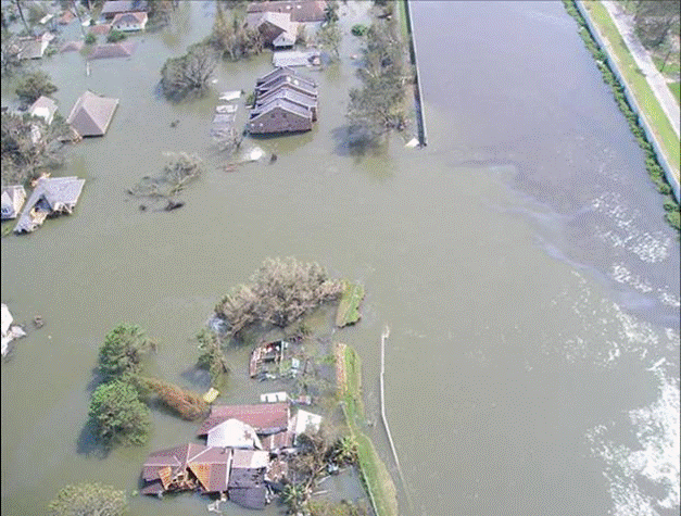
Levee Breach…Hurricane Katrina Emergency Survey